Chilean earthquake made volcanoes sink
By Anne Ju
Following a major earthquake in southern Chile in 2010, several nearby volcanoes permanently sank several inches into the ground. Cornell earth scientists think they might know why – and this knowledge could help illuminate the connection between earthquakes and volcanic activity.
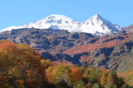
Publishing online June 30 in the journal Nature Geoscience, a study led by Matthew Pritchard, associate professor of earth and atmospheric sciences, shows that five volcanic regions within 248 miles of the 8.8-scale earthquake in Maule, Chile, sank up to 6 inches into the ground after the earthquake, almost instantly. This process, called subsidence, has never been seen on this scale in volcanic regions and could lead to insights about the “plumbing systems” underneath volcanoes, Pritchard said.
Earth scientists have long known that earthquakes sometimes trigger volcanic eruptions. “But in this case, there is strong evidence that earthquakes are also promoting some other kind of activity, which doesn’t lead to eruption in the volcanic region,” Pritchard said.
The Maule earthquake shared similar subsidence patterns with a 2011 earthquake in Tohoku, Japan, which earth scientists in Japan happened to be studying at around the same time. After comparing notes at a conference, the two unrelated research groups came to “eerily” similar results, Pritchard said: Both earthquakes seemed to induce subsidence around certain volcanic regions.
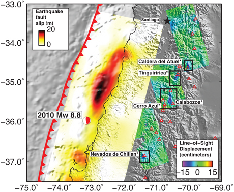
The Cornell researchers mapped the five distinct areas of subsidence following the Maule earthquake using radar imaging technology from a Japanese satellite. They think the sinking was caused by the release of extremely hot water from below the earth’s surface, or geothermal fluids, that eventually flowed out of surface streams in the area.
In volcanic areas, magma chambers under the crust heat up mineral-rich pockets of water – a resource that geothermal energy companies are trying to tap. Pritchard and colleagues contend that during the Maule earthquake, the mineral deposits were shaken loose, unclogging some pathways – like unclogging pipes in a house – which allowed a rush of water to gurgle to the surface, leading to the sinking.
Using the radar imaging technique called Interferometric Synthetic Aperture Radar, the researchers documented subtle ground deformations by reading changes in electromagnetic signals as they bounced back from the earth to the satellite. They also used sensors for infrared imaging of heat anomalies, helping them rule out the theory of subsidence being the result of a release of hot gas.
They hope their insights will inspire other scientists to continuously monitor volcanic areas in earthquake zones to further study the relationship between them – particularly, whether the subsidence is somehow either stopping or enhancing volcanic eruptions, Pritchard said.
Also, they want to discover the parameters for triggering the subsidence – how big does an earthquake have to be? How far from the earthquake zone will a volcano have to be to sink?
The paper, “Subsidence at Southern Andes Volcanoes Induced by the 2010 Maule, Chile Earthquake,” includes co-authors Jennifer Jay and Scott Henderson, both graduate students with Pritchard’s group, as well as collaborators Felipe Aron, a Cornell graduate student from Chile, and Luis Lara of the National Geology and Mining Service of Chile. The work was supported by NASA.
Media Contact
Get Cornell news delivered right to your inbox.
Subscribe