New app signals that endangered whales are nearby
By Krishna Ramanujan
A whale of an app is about to make a splash on iPhones and iPads, providing a hand-held tool for those who need to know if right whales are swimming through their shipping lanes and what to do in such an event.
The free app, called Whale Alert, provides key information that is intended to reduce the risk of ships hitting endangered right whales. With only 450-500 right whales in the world, losing even one reduces the species' long-term chances of survival. Ship collisions are a leading cause of their deaths.
The app -- developed by Cornell Lab of Ornithology's Bioacoustic Research Program (CLO BRP), the National Oceanic and Atmospheric Administration (NOAA), Woods Hole Oceanographic Institute (WHOI) and other partners -- relies on a network of 10 buoys to detect whales along Massachusetts Bay's busy shipping lanes.
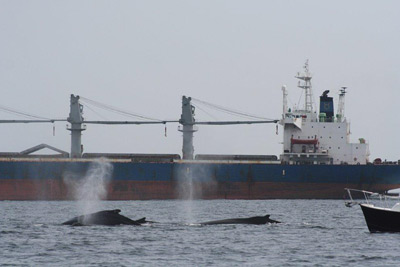
Fin, minke, humpback and right whales spend the winter-spring season in the Stellwagen Bank National Marine Sanctuary, 25 miles east of Boston Harbor, and are threatened by the 1,500 vessels that use the shipping lanes each year.
The app provides digital nautical charts, including such information as:
- current ship location;
- alerts from the network of 10 buoys in and around the marine sanctuary that recognize right whale calls within a 5-mile radius of each buoy and automatically relay information to mariners. After a call is detected, an alert remains in effect for 24 hours. Ships are advised to reduce their speed to 10 knots or less after an alert.
- warnings when a ship enters a Seasonal Management Area, an ocean area in which NOAA requires large vessels to slow down to 10 knots during a certain season.
- recommended routes to reduce collision risks. Soon, the app will offer tips and photographs to help identify right whales.
"The app allows anyone with the right tools to look at the chart and see whether there are right whales in a shipping lane," said Christopher Clark, the I.P. Johnson Director of CLO BRP who led the development of the acoustic detection buoy system with WHOI colleagues.
"This summer we will install this system in the Chukchi Sea (between Siberia and Alaska), between two areas being developed by major oil and gas companies to detect endangered bowhead whales that migrate through and feed in those waters," Clark added.
Other partners include: Earth NC (which developed the app for iPhones and iPads); Excelerate Energy; Gaia GPS; International Fund for Animal Welfare; Massachusetts Port Authority; NOAA National Marine Fisheries Service; NOAA Stellwagen Bank National Marine Sanctuary; National Park Service Cape Cod National Seashore; Suez Energy; U.S. Coast Guard; and the University of New Hampshire Center for Coastal and Ocean Mapping.
Media Contact
Get Cornell news delivered right to your inbox.
Subscribe